A city is never just buildings and roads.
It is the way stormwater moves after a hard rain. The temperature difference between a shaded neighborhood and a heat-soaked parking lot. The health of the tree canopy over a schoolyard. The gradual erosion of a slope that will not stay manageable forever.
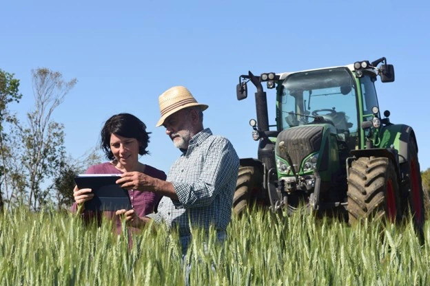
If you work in planning, public works, engineering, sustainability, or resilience, you already know the pressure: move faster, document better, spend responsibly, and make decisions the public can trust.
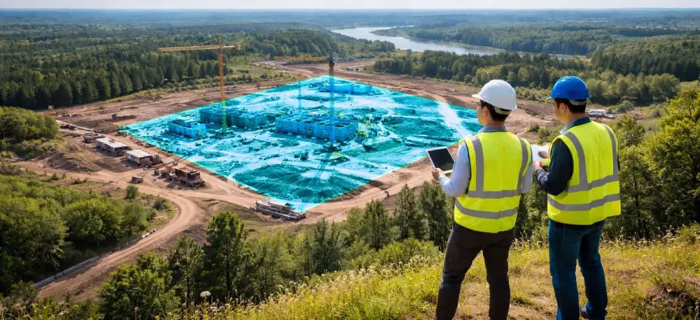
That is where environmental drone consulting becomes more than “let’s fly a drone.” It becomes a way to build an evidence layer for your city, one that supports real-world design decisions, regulatory requirements, and public-facing transparency.
At BEAD Global, we help cities, counties, agencies, and AEC teams turn drones into a repeatable program that produces decision-grade environmental deliverables, not random files scattered across a shared drive.
And yes, we do it with enough structure that the work can scale, even when staffing is thin, and priorities shift mid-project.

The problem is not “getting data.” It is making it usable.
Most cities do not struggle to collect information. They struggle to turn information into:
- Consistent baselines
- Defensible comparisons over time
- Reports that match compliance language
- Outputs that integrate into GIS, CAD, and planning workflows
- A workflow that survives staff turnover
When those pieces are missing, drone efforts stall out after a pilot. The technology is not the issue. The program is.
That is exactly what Drone consulting is meant to solve.
Why Drones Belong in Environmental Planning Conversations?
Drones have matured into practical tools for urban and environmental teams because they can be:
- Fast to deploy
- Repeatable over time
- High-resolution
- Safer than putting people into hazardous areas
In fieldwork contexts, the Utah Department of Transportation (UDOT) estimates that using UAS can reduce surveying time by as much as 50%, while also improving safety. UDOT also reports a case where obtaining and processing the data took about 2 weeks, compared to about a month with traditional surveying methods.
And when you add modern LiDAR workflows, many organizations report major labor and time reductions compared to conventional methods, sometimes cited as over 90% reductions in field labor and time for certain mapping tasks.
Speed matters when planning decisions are stacking up. One of our vetted providers, Balko Tech, says its e-LAS software can generate a calibrated, aligned, colorized, and georeferenced LAS point cloud in under 5 minutes, helping teams shorten the gap between capture and planning decisions.
Even in transportation infrastructure contexts, public agencies have documented meaningful savings. A U.S. DOT knowledge hub cites deployments that produced an overall average cost savings of 40% in a scan of UAS use cases (example: bridge inspection work).
Exact percentages will vary by site, scope, and workflow. What stays consistent is the advantage: drones can accelerate decisions and strengthen documentation when they’re implemented with intention.

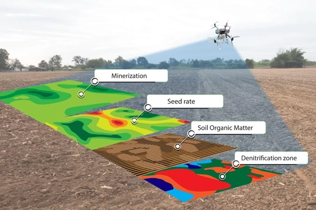
What does “Environmental Drone Consulting California” Looks Like in Real Deliverables?
California adds complexity. Coastal constraints. Sensitive habitats. CEQA documentation. Wildfire recovery. Stormwater compliance. Restrictive airspace. Public transparency expectations.
So, Environmental drone consulting in California is not just “aerial imagery.” It is a workflow that produces repeatable outputs such as:
- Orthomosaics that become a dated “site truth” layer
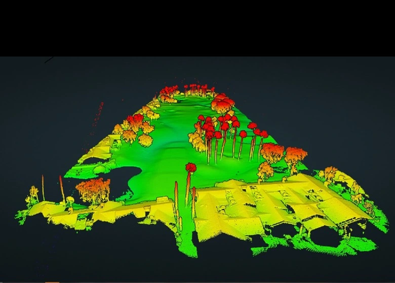
- Point clouds and surface models for grading, drainage, and slope monitoring
- Vegetation indices for urban forestry and habitat health cues
- Thermal and visual documentation for heat, water, and infrastructure interactions
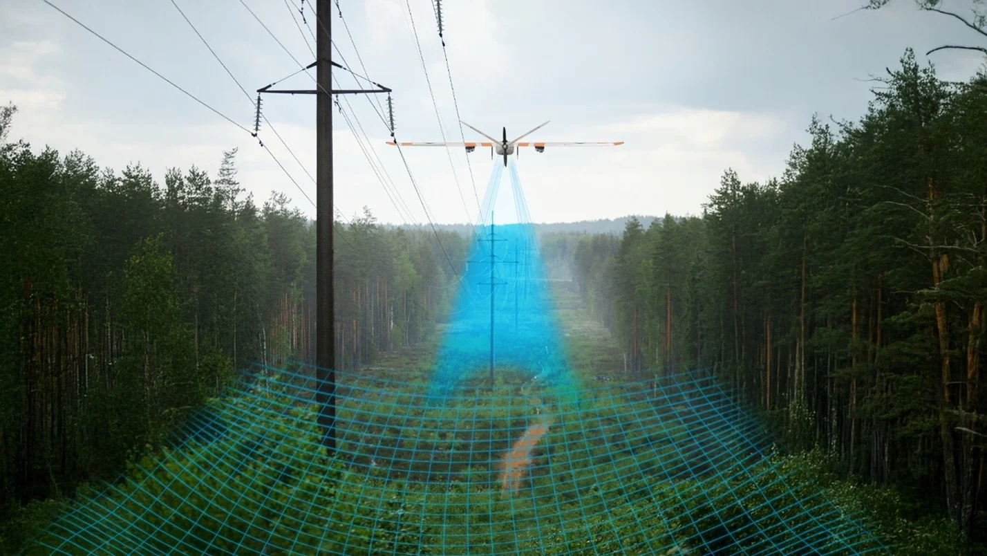
- Time-series change detection for erosion, encampment impacts, restoration areas, and construction disturbance
Urban forestry is a great example. Research on UAV-enabled urban forest tools has shown strong performance, with one recent approach reporting 95% detection accuracy in sparse canopy regions and 85% in dense canopy regions in validation testing.
That matters because cities are being asked to quantify canopy, heat, equity, and resilience. You cannot manage what you cannot measure consistently.

Where Drones Create the Biggest Wins for Smart Cities and Urban Planning?
1) Baseline environmental conditions, before the first shovel hits the ground
If you have ever had a dispute about “what was there before,” you already understand the value of a baseline.
Deliverables that typically matter:
- Ortho baseline with control and QA notes
- Existing drainage pathways and low points
- Access routes, staging constraints, sensitive buffers
- Photo logs that support reporting language
2) Stormwater, drainage, and green infrastructure verification
Smart cities are investing in bioswales, permeable surfaces, and water capture. Great. Now prove performance and document maintenance triggers.
Common outputs:
- High-resolution surface models
- Repeatable inspections after storm events
- Condition documentation for assets and inlets
San Diego’s Chollas Creek watershed begins as far east as Lemon Grove and La Mesa, then runs downstream through the City of San Diego, which means flood risk does not respect city lines. Jan. 22, 2024, a historic storm dropped 2.73 inches in 24 hours, triggering major flooding along Chollas Creek and prompting 200+ water rescues. The legal pressure has followed: attorneys began preparing class-action claims for flood victims in early 2024, and in February 2026, the City approved a $6.3M settlement to insurers who sued to recover payouts, while residents’ cases continue. FOX 5 San Diego reports the City is now countersuing some January 2024 flood victims, arguing certain property owners failed to maintain drainage on their own sites. That is exactly why cities and claimants alike need timestamped aerial baselines and repeatable change-detection that show drainage conditions, flow paths, and site changes before and after major storm events.
3) Urban heat, shade, and canopy strategy
Tree canopy is policy now, not aesthetics. Drones can support targeted planning by documenting canopy gaps and monitoring planting success over time.
Common outputs:
- Canopy maps and time-series comparisons
- Change detection after trimming, storms, or construction
- Progress documentation for urban greening projects
4) Construction impact monitoring and environmental compliance support
This is where drone programs either become priceless or become chaos.
Common outputs:
- Construction boundary verification
- Buffer documentation for habitat and waterways
- Repeatable reporting packages aligned to permit conditions
- Photo evidence that can reduce finger-pointing
5) Resilience planning: wildfire, coastal erosion, slope risk, and recovery documentation
Cities are being asked to plan for hazards and also provide response and recovery steps.
Common outputs:
- Pre-event baselines
- Rapid post-event documentation
- Repeatable monitoring of recovery areas
Another of our vetted DSPs, Birds Eye Aerial Drones’ ongoing NCTD coastal rail monitoring is a great example of the above. The team first establishes a high-resolution baseline of the bluff face and track-adjacent slopes, then repeats the same flight plan on a set cadence. Each new dataset is processed against the baseline to produce a simple change-detection output that highlights where material has been lost, where runoff is carving new channels, and which segments are trending toward risk. That gives Verdantas and NCTD a clear, defensible way to prioritize geotechnical review and stabilization planning before erosion becomes a service interruption.

The Trust Layer: Public Transparency and Defensible Reporting
Smart cities are judged on outcomes and on how well they can explain the “why” behind decisions.
Drone deliverables support trust when they are:
- Dated
- Repeatable
- Tied to a documented method
- Clearly organized for internal and external stakeholders
This is where program governance matters. Without it, even good data becomes a liability.
Our Approach at BEAD Global: Build the Program, Not Just the Flight
If you are searching for drone consulting in California, here is what you should expect from a true consulting partner:
Step 1: Align on the decision your team needs to make
Not “what drone do we buy,” but:
- What decision will this data support
- Who consumes it
- What format do they need
- How frequently must it be updated
Step 2: Define the deliverable standard
You do not want “pretty.” You want:
- Resolution requirements
- Accuracy expectations
- QA/QC checks
- Metadata expectations
- File naming, storage, and access rules
Step 3: Build the repeatable workflow
This is the difference between a pilot and a program:
- SOPs
- Training requirements
- Compliance planning (airspace, Remote ID, privacy)
- Vendor management, if outsourced
- Templates for reporting and stakeholder updates
Step 4: Implement through a Vendor-Select Execution Model
BEAD Global is not a drone service provider. We operationalize programs and, when execution is needed, we can support through a Vendor-Select Execution Model so cities get the right capability for the job while keeping standards consistent.
This is where environmental drone consulting services become a force multiplier. You do not have to build everything in-house to run a tight program.
If You Are Considering Building an In-House Drone Program
I love a capable internal team. I also love when that team is not set up to fail.
If your city is thinking, “We will just buy a drone and figure it out,” please pause and ask:
- Do we have standardized deliverables defined
- Do we have a documented QA/QC process
- Do we have clear privacy and data governance rules
- Do we have continuity built in if the main pilot leaves
- Do we know how this integrates into GIS and reporting
- Do we understand airspace and how to legally fly in our airspace
- Do we have the correct insurance
This is exactly when environmental drone consulting pays off. Not because your team cannot fly, but because your program needs to stand up to scrutiny.

Pro Tips for Planning Teams That Want Results This Quarter
- Start with one high-value use case and a repeatable schedule (baseline + monthly or quarterly updates).
- Define “done” before you fly. File formats, resolution, naming, delivery timeline, and who signs off.
- Build a simple reporting template that aligns with compliance language and public updates.
- Create a change-detection habit. The power is in “before and after,” not a single snapshot.
- Do not let software choices drive your workflow. Your workflow should drive your tools.
The Question Worth Asking Right Now
What would change for your city if you could answer these with confidence, every time?
- What is true on the ground today
- What changed since last month
- What is trending toward risk
- What proof do we have for regulators, leadership, and the public
That is the heart of smart city implementation. Not technology for technology’s sake, but clarity that leads to better decisions.
If you are exploring Environmental drone consulting in California, or you need Drone consulting in California that actually builds a scalable program, let’s talk.
BEAD Global helps smart city teams move from “we tried drones once” to “we have a repeatable environmental evidence layer that supports planning, resilience, and reporting.”
Reply here or reach out through BEAD Global, and we will set up a short discovery conversation to map your first use case, the stakeholders involved, and the fastest path to a program you can defend.