Farming has always required vision. The ability to look at a field and understand what is happening beneath the surface, what is coming next, and where intervention matters most. Today, that vision is no longer limited to what the eye can see from the ground. It is being transformed from above.
Across California and beyond, GIS drone consulting is redefining how growers make decisions, conserve resources, and protect yield. Precision agriculture is no longer a future concept. It is an operational advantage.
The Challenge Farmers Face Today
Modern agriculture is complex. Fields are larger. Weather patterns are less predictable. Water is more precious. Inputs are more expensive. At the same time, growers are being asked to produce more with less while meeting environmental and regulatory expectations.
Traditional scouting methods and static data sets struggle to keep pace with these realities. By the time issues are visible from the ground, the opportunity for early intervention is often gone.
This is where precision agriculture drones step in and where strategy matters just as much as technology.
What Makes GIS Drone Consulting Different?
Flying a drone is not the same as extracting value from drone data. True impact happens when aerial data is paired with geospatial intelligence, agricultural expertise, and decision-ready outputs.
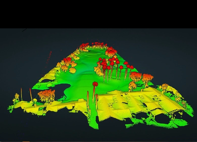
GIS drone consulting combines high-resolution aerial capture with spatial analysis, modeling, and interpretation. The result is not just imagery, but insight.
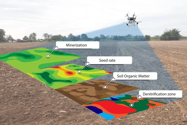
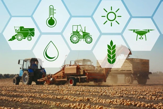
Through agricultural drone mapping, growers gain access to field-wide intelligence that reveals variability in crop health, irrigation performance, soil conditions, and plant stress long before issues become visible from the ground.
When paired with drone data analytics in farming, this information becomes actionable. Zones can be prioritized. Inputs can be targeted. Crops can be counted. Resources can be deployed with confidence.
Why California Agriculture and Agronomy are Leading the Shift?
California’s agricultural landscape is uniquely complex. Diverse crops, water constraints, regulatory pressure, and climate variability demand smarter tools.
That is why agriculture drone consulting California has emerged as a critical capability rather than a nice-to-have.
Working with an advanced drone consultant in California means understanding local growing conditions, water management realities, and compliance considerations. It also means delivering outputs that integrate directly into existing farm management systems, GIS platforms, and agronomic workflows.
At BEAD Global, our role as advanced drone consultants is to bridge the gap between aerial data and operational decision-making.
Also Read: How GIS Drone Consulting Is Revolutionizing Land Surveying in the USA?
The Measurable Impact of Precision Agriculture Drones
The results speak clearly.
- Precision agriculture practices supported by drone and GIS data can reduce fertilizer and chemical use by up to 30 percent through targeted application.
- Early detection of crop stress using multispectral drone data can improve yield outcomes by 10 to 15 percent in high-value crops.
- Drone-based field analysis allows growers to inspect 100 percent of acreage, compared to less than 5 percent through manual scouting alone.
- Irrigation optimization informed by aerial mapping can reduce water usage by 20 percent or more, a critical advantage in drought-prone regions.
- High-resolution turf analytics detect early stress in greens, tees, and fairways, enabling corrective action 7–14 days earlier than visual inspections.
- Drone-based zone mapping enables precision treatments on high-value turf, reducing water and chemical use by 15–25 percent while improving surface consistency and playability.
These are not theoretical gains. They are operational realities when drone programs are implemented strategically.
Pro Tip for Growers and Ag Operators
Do not start with the drone. Start with the decision.
Before deploying aerial technology, define the questions you need answered. Are you trying to reduce water usage? Improve uniformity? Identify the disease early? Validate contractor performance?
An experienced advanced drone consultant will design the data capture, analytics, and reporting workflow around those outcomes. That is where ROI is created.
Where BEAD Global Fits In?

BEAD Global is not a drone service provider. We are a strategic partner.
Through our consulting model, we help agricultural operators, cooperatives, agronomists, and ag-tech teams design and implement scalable drone programs using a vendor-select execution model. That means the right platforms, the right data standards, and the right partners for each operation.
Our GIS drone consulting services focus on readiness, integration, and long-term value. From program design and data architecture to analytics workflows and stakeholder alignment, we ensure drone intelligence actually supports how farms operate.
The Future of Farming Is Informed From Above
Precision agriculture is not about flying more drones. It is about making better decisions, faster, with confidence.
Growers who embrace precision agriculture drones, agricultural drone mapping, and drone data analytics in farming are not just responding to today’s challenges. They are building resilient, efficient operations ready for what comes next.
If you are exploring how agricultural drone consulting in California can support your operation, BEAD Global is ready to help you design what comes next.
Let’s talk about what your data should be telling you and how to turn insight into action.