Failures in commercial drone inspections rarely come from a single bottleneck. The root cause is almost always the failure to scale the entire ecosystem that supports them, including hardware, flight operations, compliance, data processing, and analysis. It’s all one unified system.
Unless flight operations can process data as fast as it arrives, unless your compliance strategy is built into aircraft design (not bolted on after the fact), and unless your hardware can sustain extended endurance missions across miles of corridors, you’ll fail to reach true scale.
Scaling doesn’t mean deploying more aircraft across your network independently. It means building an aerial intelligence network, a connected ecosystem of flight, data, and decisions. That’s exactly where Censys Technologies comes in.
The Scaling Problem Across Industries
Whether operating in utilities, transportation, infrastructure, agriculture, or construction, enterprise organizations are under pressure to inspect more assets, respond faster, and reduce costs. Yet even mature, well-funded UAS programs begin to break down when they try to scale from localized inspection areas to corridor-level operations.
These breakdowns don’t occur in isolation; they compound across the system.
Hardware Isolation
Multirotor drones work fine when you’re inspecting one site. But when every drone requires its own dock and sits idle for hours to recharge, you end up with a patchwork of small, disconnected systems. That’s expensive, inefficient, and fundamentally incompatible with corridor-scale inspections.
Data Silos
Flight crews execute missions along preplanned routes, while data workflows often operate separately from mission operations. High-resolution imagery may sit unprocessed for hours, days, or even weeks, delaying insights and slowing response cycles.
Not Built for Compliance
Flying BVLOS isn’t optional. Anticipating the FAA’s forthcoming Part 108 rule for BVLOS autonomous UAS means designing systems from the ground up to meet performance-based safety and workflow standards. Without that compliance first foundation, your program isn’t truly airborne.
System Level Scale by Design
The fix for flight operations that plateau isn’t about swapping out aircraft. It’s rethinking the system itself.
Censys takes a systems-level approach to UAS design, with scale as a core requirement. Airframe engineering, mission operations, and edge data processing evolve together, ensuring that each layer of the workflow supports corridor-level autonomy.
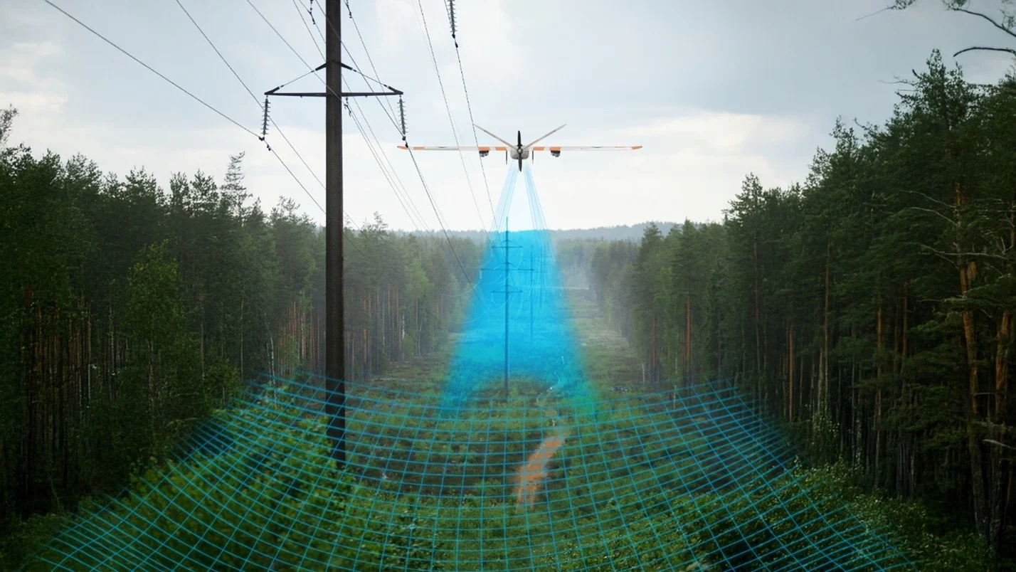
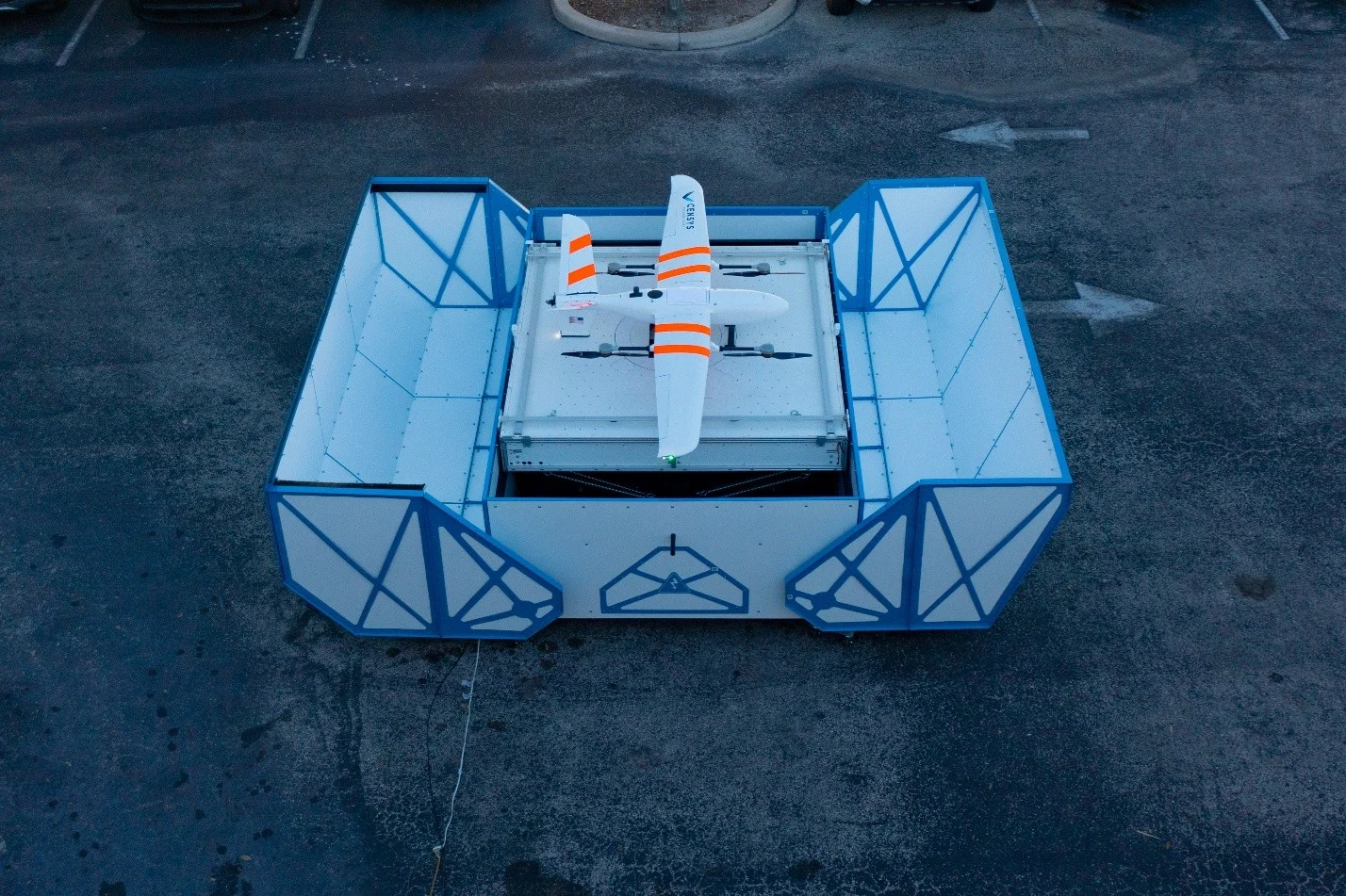
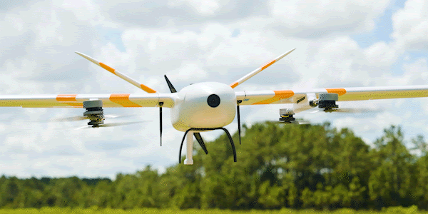
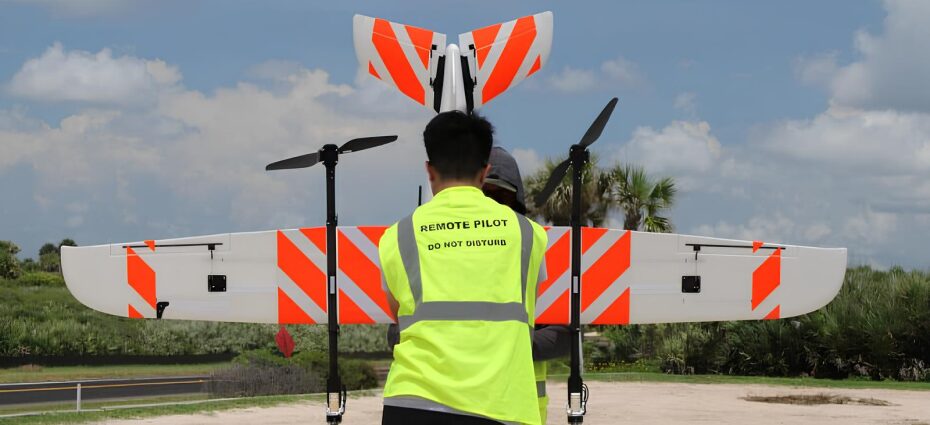
It starts with the Sentaero 6 EdgeDock™, a multi-hour, autonomous fixed-wing VTOL UAS paired with purpose-built ground infrastructure. Each EdgeDock acts as both a launch and recovery point and an edge computing node for data captured during flight. Aircraft
Edge Processing
Each EdgeDock is both an aircraft charger and an analytics node. Data gets processed where it’s collected, eliminating cloud bottlenecks. High-fidelity processed imagery and other decision-grade data flow directly to enterprise dashboards.
Regulation Ready Operations
Deploying aircraft with operational confidence means proactively aligning with the FAA’s performance-based BVLOS framework under Part 108. Censys’ autonomy and architecture are built around those standards, enabling compliance by design, not by exception.
Persistent Operations
Launching and recovering aircraft shouldn’t require a full crew. The Censys remote flight planning and recovery workflow runs while your teams work, ensuring 24/7 coverage with minimal intervention.
There has never been a more critical time to invest in operations you can trust.
Scaling Infrastructure Inspection: Lessons Learned
For decades, industries managing extensive linear infrastructure have relied on reactive, inspect to fail models. U.S. power utilities alone operate tens of thousands of miles of transmission corridors, each with thousands of individual inspection points. At this scale, local inefficiencies compound into billions of cumulative operational costs.
The impact of system-level design becomes clear here. Utilities, transportation agencies, and infrastructure operators aren’t just flying missions; they’re managing complex, distributed networks that demand continuous awareness at scale.
That’s why large utilities are among Censys’s biggest customers, not because we’re the biggest, but because we think as they do. Maintenance managers deploying autonomous inspection networks with Censys aren’t planning inspections once every 5 to 10 years. They’re building scalable, persistent aerial networks that compress those cycles from years to days. And beyond flight efficiency, these teams are unlocking preventative intelligence, keeping their “eyes in the sky” on high-value assets day in and day out.
Putting It All Together: Scaling UAS Beyond Flight
Think about every bottleneck your inspection workflow has faced. Now double your flight teams to fix it. That model scales flight activity, not efficiency.
The FAA’s forthcoming Part 108 rule will enable autonomous UAS networks to operate across wide service areas, but only for systems engineered to scale in safety, reliability, and data continuity. That future is already taking shape at Censys.
About Censys
Censys Technologies is an American airborne intelligence company developing autonomous aerial systems that deliver real-time, decision-grade data for industrial, environmental, and infrastructure applications. The Sentaero 6 EdgeDock™ network is redefining what’s possible in persistent BVLOS UAS inspections by maintaining continuous aerial visibility over high-value assets through autonomous operations and system-level human oversight.