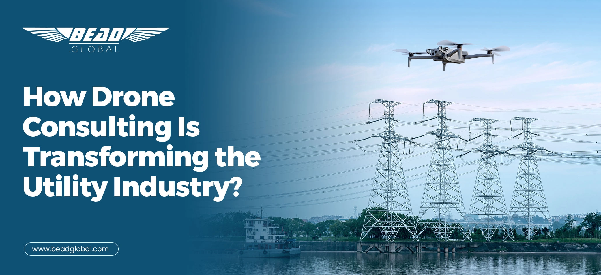
There is a moment utility leaders know well.
The weather is shifting. Fire risk is climbing. A line corridor stretches for miles across hard terrain, aging infrastructure, vegetation pressure, and communities that expect the lights to stay on. Everyone wants faster answers, cleaner reporting, fewer surprises, and proof they can actually use.
That is where Drone Consulting starts changing the conversation.
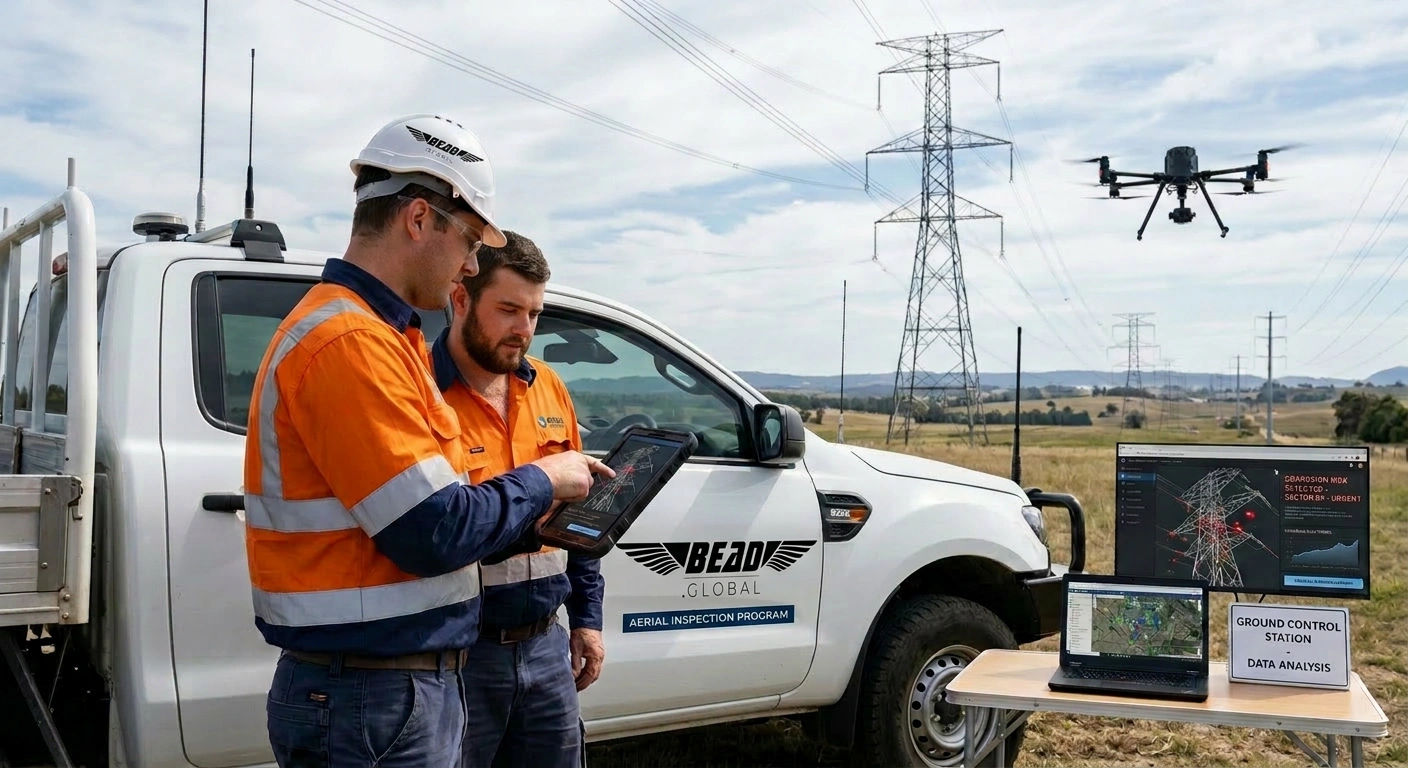
Because this is no longer just about putting a drone in the air. It is about building a program that helps utilities see risk sooner, document conditions better, and move from reactive fieldwork to repeatable decision-making. The drone may collect the data, but the consulting layer is what makes the operations more effective and compliant, and the data matters.
The timing is not accidental. The drone ecosystem is more mature than ever. As of December 31, 2024, the FAA reported nearly 427,631 UAS remote pilots, and its 2025 aerospace forecast noted that more than 1.61 million recreational drone owners had registered cumulatively by the end of 2024. At the same time, the U.S. Department of Energy states that drones for utility asset inspection allow safer and more frequent inspections, enhanced asset information, reduced operational costs and failure rates, and faster damage assessments that reduce restoration timelines.
So yes, the aircraft matters. The sensors matter. The pilot’s matter.
But for utilities, the reality is this: the winners are not just collecting more imagery. They are building smarter systems around it.
When The Old Way Starts Showing Cracks?
Utilities are being asked to do more with higher stakes and less room for ambiguity.
In California, especially, the pressure is structural, not seasonal. The Office of Energy Infrastructure Safety requires electrical corporations to submit Wildfire Mitigation Plans describing how they will construct, maintain, and operate electrical lines and equipment to minimize catastrophic wildfire risk. PG&E has also highlighted the scale of aerial inspection work already underway, noting 220,000 poles leveraged through aerial inspections in 2024 and 2025. Nationally, the National Interagency Fire Center reported 77,850 wildfires burning 5,131,474 acres in 2025.
That kind of operating environment exposes a hard truth. Most utility challenges are not caused by a lack of flights. They are caused by a lack of workflow.
Data shows up in different formats. Crews capture inconsistent shots. Reporting is hard to compare from one cycle to the next. Operations, engineering, vegetation, and compliance teams all need something slightly different. Leadership wants clarity, while field teams want practicality. And somewhere in the middle, valuable data gets trapped in folders, delayed in review, or weakened by inconsistency.
That is why utility drone consulting is becoming so important.

What The Best Drone Consulting Company Actually Does?
Here is the question worth asking:
What makes the best drone consulting company valuable to a utility?
It is not the company with the loudest marketing.
It is not the one with the fanciest aircraft photos.
It is not even the one that flies the most missions.
It is the one that can connect field capture to operational outcomes.
That means designing the inspection strategy before takeoff. It means deciding what needs to be captured, how often, by whom, under what standard, and in what format it will be reviewed, escalated, stored, and acted on. It means creating a repeatable path from corridor to dashboard, from anomaly to action item, from field image to executive confidence.
A strong consulting-led utility drone program usually defines:
a defensible baseline, a recurring capture cadence, approved shot lists, metadata and naming standards, QA/QC rules, anomaly classification logic, delivery timing, reporting expectations, and stakeholder roles.
That is where consulting earns its keep.
Because when a utility can compare one dataset to the next without debate, decisions get faster. When imagery aligns with maintenance priorities, teams stop drowning in files and start finding what matters. When reporting is structured correctly, drone work supports capital planning, wildfire mitigation, vegetation management, reliability strategy, and post-event response instead of sitting off to the side as a nice extra.
Why Does the View Get Clearer with Consulting?
The utility industry does not need more disconnected drone activity. It needs orchestration.
In practice, utility drone consulting in USA is becoming less about isolated missions and more about program design. The most effective teams are treating drones as part of a broader operating system that includes risk prioritization, inspection planning, compliance alignment, and decision-ready reporting.
That matters because utilities are not managing one simple need. They are balancing transmission and distribution asset health, vegetation encroachment, wildfire exposure, storm response, contractor oversight, documentation standards, public accountability, and internal budget pressure, all at once.
Consulting helps utilities answer the questions behind the flight:
What assets matter most right now?
Which corridors need recurring visibility?
What evidence will be used to engineer trust?
What formats will operations actually use?
What will leadership need when the next audit, storm, or board update arrives?
Those are not pilot questions. Those are program questions.
And good consulting turns them into field-ready answers.

Also Read: From Helicopters to UAVs: The ROI of Modernizing Utility Inspections
Why is California Setting the Pace?
This is especially true for utility drone consulting in California.
California utilities operate under a uniquely visible mix of wildfire scrutiny, terrain complexity, public attention, and documentation pressure. That forces programs to mature quickly. Flights have to be safe, yes, but also defensible. Deliverables have to be useful, not just technically impressive. Data has to support action.
In other words, California has become a proving ground for what utility drone programs look like when the stakes are real.
That is one reason the broader market pays attention to what works here first.
The consulting lesson is simple: utilities do not just need aerial data. They need aerial data that fits the realities of risk, regulation, review cycles, field execution, and leadership reporting.
What Transformation Actually Looks Like?
When consulting is done well, the transformation is not flashy. It is practical.
A utility that once ordered one-off flights starts building a repeatable inspection program.
A team that used to receive folders of mixed imagery starts receiving structured deliverables tied to real use cases, such as span imagery, pole condition documentation, vegetation encroachment review, orthomosaic context, anomaly logs, and compliance-ready metadata packages.
A manager who used to ask, “What am I looking at here?” starts asking, “How fast can we act on this?”
That is the difference.
The flight becomes part of a system.
The system becomes part of operations.
Operations become more proactive.
And suddenly, drones are no longer being judged as a novelty or a line item. They are being judged by what they help the utility prevent, prove, prioritize, and plan.
Where BEAD Global Fits?
At BEAD Global, we believe the future belongs to utility programs that are built intentionally.
Not just flown, not just purchased, but built.
That means starting with the problem, not the aircraft. It means designing around the client’s risk profile, geography, reporting needs, stakeholders, and scope. It means using the right field partners through a vendor-select model when needed, while keeping strategy, quality, and program design aligned from start to finish.
Because the real value of consulting is not that it makes drone work possible.
It makes drone work useful.
And in the utility industry, useful is what moves projects forward.
Final thoughts
Utilities have entered a season where visibility is no longer optional. The grid is too critical, the terrain is too demanding, the reporting is too important, and the consequences of delay are too expensive.
Drone programs can absolutely help.
But drone consulting is what turns those programs into something stronger: a repeatable source of clarity.
That is the transformation.
Not more data for the sake of data, but rather better decisions, made sooner, with proof to back them up.
Is It Your Time for Drone Consulting?
If your team is still buying flights one mission at a time, this may be the right moment to step back and design the program around what the utility actually needs to see, decide, and defend.
BEAD Global helps utilities build drone strategies that support field execution, documentation, and decision-ready reporting, so the data does more than look impressive. It becomes operationally useful.