Seeing the Earth Differently
Land surveying has always been the quiet backbone of American progress. From mapping new highways and housing developments to restoring wetlands and assessing wildfire damage, survey data shapes nearly everything we build and protect. But the tools and timelines that once defined the industry are rapidly changing.
At BEAD Global, we’ve seen that transformation up close. What once required weeks of manual measurement, ground crews, and heavy equipment can now be accomplished in a fraction of the time, more safely, sustainably, and with far greater precision. The reason is simple: GIS drone consulting is helping surveyors revolutionize how we see and manage the world beneath us.
This isn’t about replacing human expertise; it’s about augmenting it. When geospatial intelligence meets aerial autonomy, surveyors, engineers, and planners gain something extraordinary: a living, breathing map that updates in real time.
1. Precision That Redefines What’s Possible
Traditional surveying has always carried a margin of error; weather, terrain, or human variability could shift the final numbers. With GIS-integrated aerial drone consulting, accuracy improves dramatically.
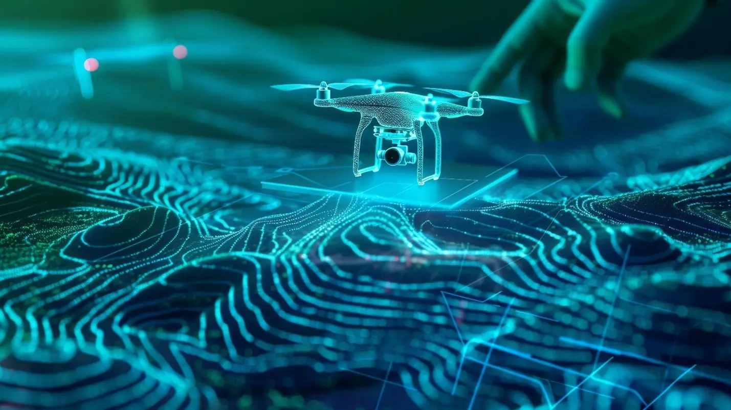
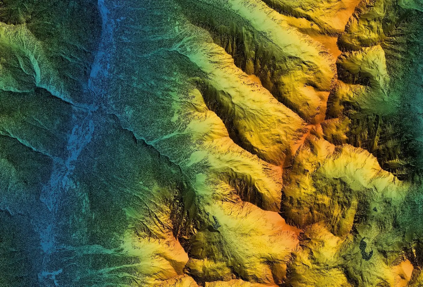
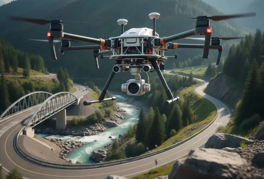
Drones equipped with RTK (Real-Time Kinematic) and PPK (Post-Processed Kinematic) positioning capture centimeter-level precision, even across complex terrain. Combined with advanced photogrammetry and LiDAR sensors, these aerial systems generate dense, geo-referenced point clouds that traditional ground equipment could never match in speed or density.
For construction, energy, engineering, or environmental projects, that precision means fewer reworks, fewer disputes, and faster approvals. And for asset managers, it means a digital twin, a dynamic, data-rich model that can be updated as the landscape evolves.
Pro Tip: The difference between traditional GPS data (±5 m accuracy) and RTK drone data (±2 cm accuracy) can redefine project tolerances and directly impact ROI.
2. Efficiency That Saves Time, Money, and Resources
Speed is no longer a luxury; it’s a necessity. Projects across the U.S. are expected to deliver results faster, under tighter budgets, and often with fewer skilled personnel available.
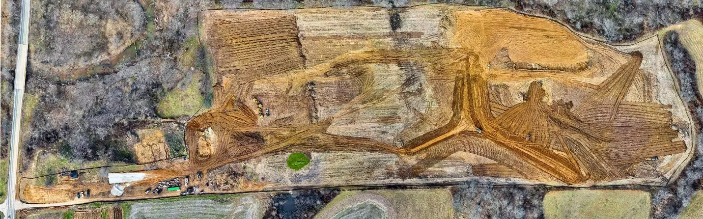
Drone consulting services from BEAD Global help organizations meet those demands by compressing survey timelines. What once took weeks of manual data collection can now be achieved in hours with a single drone team.
For example, a 200-acre construction site that traditionally required five ground crew days can now be fully mapped in a two-hour flight. That efficiency extends beyond the field.
Data processing workflows, powered by GIS software and cloud-based modeling, deliver visualizations and reports that stakeholders can interpret instantly.
In short: Faster data → faster decisions → faster progress.
At scale, that efficiency becomes transformative. Engineering firms, municipalities, and utilities are saving thousands of labor hours annually through drone consulting company partnerships that integrate UAV workflows into their standard operations.
Also Read: Top Industries Benefiting from Drone Consulting Today
3. Safety That Protects People and Projects
Safety is more than compliance; it’s culture. BEAD Global has long championed a “zero-footprint, zero-harm” approach for drone operations, and GIS drone consulting extends that mindset into the field.
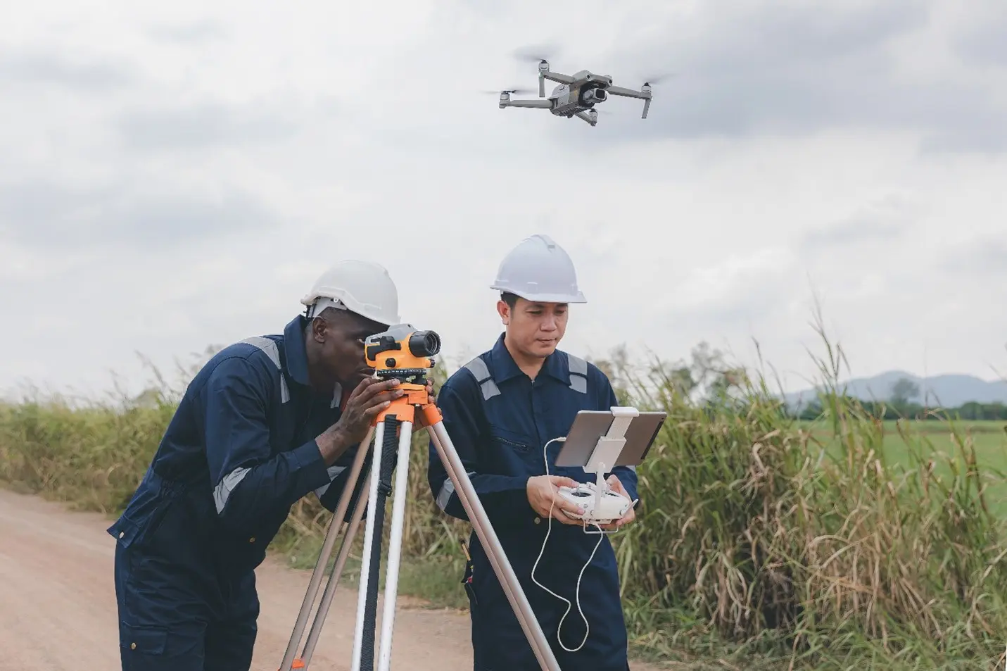
Land surveying often requires human teams to navigate steep slopes, active construction zones, floodplains, or post-disaster areas. Drones eliminate those risks. Instead of sending crews into harm’s way, operators capture the same data remotely, often in a matter of minutes.
This isn’t only safer for field teams; it’s safer for clients. Reduced exposure, fewer site visits, and better documentation mean lower liability and insurance costs. Drones also provide a time-stamped, verifiable visual record that strengthens regulatory compliance and quality assurance documentation.
Fact: According to OSHA, over 20% of workplace fatalities in 2024 occurred in construction-related fields. Drone integration can reduce those risks by up to 60%.

4. Insights That Go Beyond the Surface
The true power of aerial drone consulting isn’t just in the data, it’s in what you can do with it.
Through GIS drone consulting, BEAD Global helps clients learn how to unlock a deeper layer of intelligence by combining photogrammetry, LiDAR, infrared, and thermal imagery with sophisticated GIS analytics. This multi-sensor fusion reveals patterns invisible to the naked eye: subtle elevation changes, vegetation stress, drainage issues, or early signs of structural fatigue.
With these insights, project managers can make proactive, data-backed decisions rather than reactive ones. For civil engineers, that could mean identifying erosion before it threatens infrastructure. For environmental scientists, it might mean mapping carbon sinks or tracking post-wildfire recovery.
Every dataset becomes a story, and when told through GIS visualization, that story empowers stakeholders to see not just what is, but what’s possible.
Did you know? Aerial LiDAR surveys generate up to 100 points per square meter, compared to just 1–2 points using traditional methods.
5. Sustainability That Supports the Future
Sustainability isn’t just about protecting the planet; it’s about designing smarter systems that last. Drones play a central role in that shift.
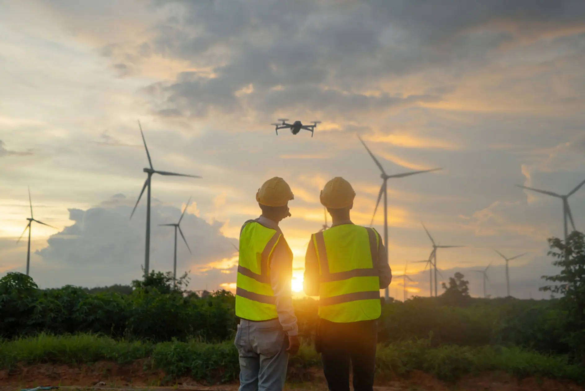
By reducing fuel use, soil disturbance, and the number of heavy vehicles required on-site, drone consulting services help minimize a project’s carbon footprint. They also enable ongoing environmental monitoring, allowing organizations to track restoration efforts, biodiversity, and long-term ecological impacts.
In rural America, agricultural and environmental GIS programs are leveraging drones to analyze soil moisture, detect irrigation issues, and monitor conservation areas—all while reducing manual intervention. For utility and transportation sectors, drones are helping extend the life of assets through regular, non-invasive inspections.
At BEAD Global, sustainability is built into our mission. We believe that every drone flight should deliver value to our clients, to their communities, and to the ecosystems they operate within.
6. Integration That Bridges Innovation and Reality
Technology alone isn’t enough; it needs structure, strategy, and people. That’s where drone consulting companies like BEAD Global come in.
We guide clients through every phase of integration:
- Assessment: Evaluating mission needs, safety requirements, and ROI potential.
- Implementation: Deploying aircraft, sensors, and GIS workflows customized to each project.
- Maximization: Training teams to analyze, interpret, and apply aerial data effectively.
Our approach turns “data-rich but insight-poor” workflows into actionable intelligence systems. We help clients understand not only what the drone sees, but what it means.
For large-scale infrastructure, that means tighter quality control. For municipalities, it means transparent, data-backed planning. For environmental partners, it means verifiable sustainability reporting.
7. Collaboration That Elevates Everyone
One of the most inspiring outcomes of this new era of aerial mapping is collaboration. When organizations embrace drone consulting services, they open doors to multi-agency coordination, shared datasets, and cross-disciplinary insights.
At BEAD Global, we’ve worked alongside utilities, universities, government agencies, and engineering firms to standardize data frameworks and align drone programs with FAA, OSHA, and state environmental standards. The result: consistency, safety, and scalability that advance entire industries.
This is more than innovation; it’s stewardship. And it’s how BEAD Global defines success: not just by the data we capture, but by the value we create together.
The Future of Land Surveying Has Taken Flight
What once required tripods, total stations, and long field hours is now managed with cloud-based dashboards and centimeter-accurate aerial scans. Land surveying, as an industry, has taken flight, and GIS drone consulting is the compass guiding it forward.
BEAD Global is proud to be part of that transformation. As a drone consulting company, our mission is to empower others to see differently, plan intelligently, and act decisively. Every flight, every dataset, every partnership carries a shared purpose: to make work safer, projects smarter, and outcomes more sustainable.
From city planners designing tomorrow’s neighborhoods to engineers rebuilding after wildfires, precision from above is giving us a clearer, more connected view of our world.
Because progress doesn’t just happen on the ground, it happens when we rise above it.
Ready to Elevate Your Next Project?
Discover how GIS Drone Consulting with BEAD Global can streamline your surveying, mapping, and planning operations.
✈️ Learn more at beadglobal.com